A hiking route through the beauties of Valmalenco.
- Difficoltà: Hiker
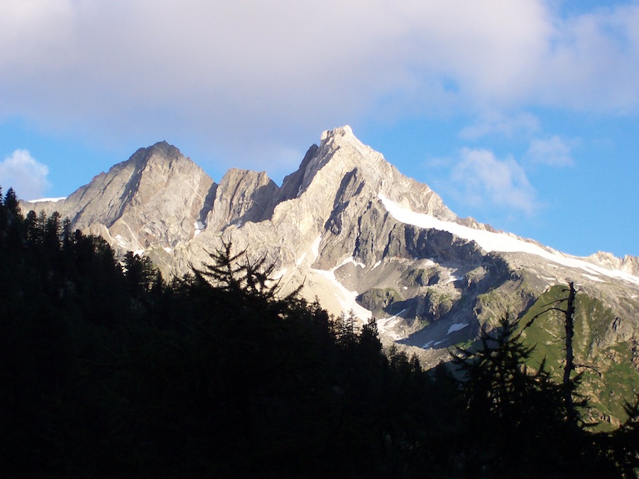
The Ridgeway of Valmalenco is a route in stages connecting several huts at high altitude, stretching over 100 km: eight stages to discover the most spellbinding scenery in the heart of the Rhaetian Alps.
The Ridgeway of Valmalenco is a long hiking crossing at high altitude and comprising 8 stages, that can usually be traveled in 8 days, with an overall length of as many as 110 km, from Torre S. Maria to Caspoggio.
The Ridgeway can be traveled in its entirety, by getting back to the point of departure, as a kind of loop, or by choosing partial stretches, mini Ridgeways of only 2 or 3 days.
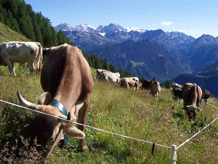
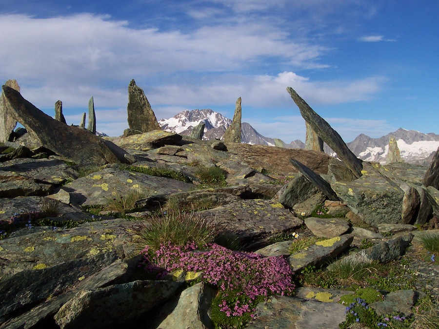
The Ridgeway twists and turns along the entire mountain range of Valmanenco and crosses the Disgrazia, Bernina and Scalino Groups, along a trail – from the second stage – mostly above 2000 metres.
A big classic of the Rhaetian Alps, an experience which allows everyone (with appropriate physical training and hiking equipment for the most demanding stretches) to go straight to the heart of the mountains, by choosing the main route or the variants connecting the principal huts of Valmalenco.
Between Alpine meadows, pastures, lakes, woods, quarries and mountain passes, the route includes the most scenic stretches of the valley: the Basin of Chiareggio, the Lake Palù, the big valley of Scerscen, Campo Moro and Campo Gera dams, Disgrazia, Bernina and Scalino Glaciers.
THE EIGHT STEPS:
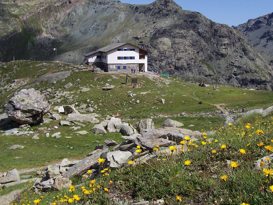
Torre Santa Maria (hamlet of Ciappanico) – Alp Piasci – Cometti Hut (1720 m.) – upper Arcoglio (2123 m.) – Bianca Peak (2490 m.) – Bosio Hut (2086 m.)
Bosio Hut (2086 m.) – Alp Mastabbia (2077 m.) – Alp Giumellino (1756 m.) – Lakes Sassersa (2369 m.) – Ventina Pass (2675 m.) Alp Ventina (1960 m.)
Alp Ventina (1960 m.) – Forbicina (1656 m.) – Sissone Valley –Del Grande Hut (2600 m.) – Chiareggio (1612 m.)
Chiareggio (1612 m.) – Longoni Hut (2450 m.) – Alp Sasso nero (2304 m.) – Lago Palù Hut (1947 m.)
Lago Palu Hut – Bochel del Torno (2208 m.) – Alp Campascio (1844 m.) – Alp Musella (2021 m.) – Carate Hut (2636 m) – Marinelli Hut (2813 m.)
Marinelli Bombardieri Hut (2813 m.) – Bocchetta di Caspoggio (2983 m.) – Alp Fellaria and Bignami Hut (2382 m.)
Bignami Hut (2382 m.) – Alp Gembrè (2190 m.) – Alp Val Poschiavina (2230 m.) – Canciano Pass (2464 m.) – Campagneda Pass (2601 m.) – Cristina Hut (2227 m.)
Cristina Hut (2227 m.) – Alp Acquanera (2116 m.) – Piazzo Cavalli (1710 m.) – Caspoggio (1098 m.) – Torre di Santa Maria (772)